IBM’s New Environmental Intelligence Platform Delivers Data Via APIs

IBM has launched the beta version of its Environmental Intelligence (EI) platform, providing developers and data scientists with curated environmental insights powered by AI. The platform offers access to open-source geospatial and satellite data, enabling the creation of applications focused on sustainability, climate change, and regulatory compliance.
This cloud-based platform features various geospatial, weather, and climate APIs, helping users address issues like climate disruptions and financial risks. Both the public and private sectors are grappling with climate-related challenges, including operational disruptions, asset damage, and supply chain vulnerabilities. IBM’s Environmental Intelligence platform delivers geospatial data, advanced models, and AI-driven insights to assist organizations in tackling these challenges.
David Blanch, IBM’s director of product management for ESG and Environmental Intelligence, shared with TechNewsWorld that while the product is new, it draws on years of research from IBM’s sustainability and climate science community. This research focuses on addressing specific industry and climate-related problems with forward-thinking solutions.
API Suite for Environmental Insights
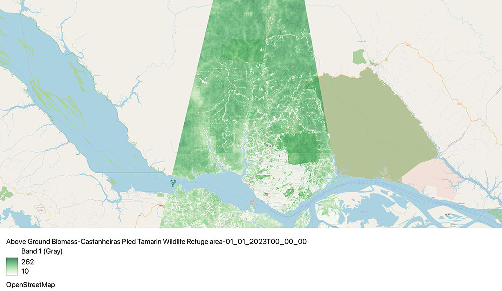
IBM’s EI platform offers a versatile suite of APIs designed to help developers and data scientists gather and analyze Earth’s surface data for predictive insights and proactive decision-making. It simplifies working with public satellite data by processing, normalizing, and organizing it into geospatial layers, making it easier for users to analyze and visualize the data.

IBM’s Environmental Intelligence (EI) platform offers a comprehensive suite of tools designed to provide actionable environmental insights through high-resolution imagery, weather data, and other valuable datasets. This includes APIs and a Python SDK that grant access to global weather data, enabling quicker decision-making and predictive analysis. The platform leverages a foundation model co-developed with NASA to process and cleanse geospatial data, ensuring its quality and usability.

Key Features of the EI Platform
- Real-Time Analysis: The platform features easy-to-use APIs that provide seamless access to environmental and geospatial datasets, facilitating real-time analysis. It enables users to query both geospatial and temporal data for enhanced insights, improving application functionality.
- Historical Weather Data: On-demand access to past weather data allows businesses to inform predictive models, optimize operations, and make better decisions across various sectors.
- Advanced Data Querying: Users can execute complex queries on diverse environmental datasets, customizing spatial and temporal resolutions to meet specific needs.
- Automated GHG Emissions Calculation: The platform automates the calculation of greenhouse gas (GHG) emissions, enabling businesses to track and manage their carbon footprints, including emissions from both internal operations and supply chains.
The beta version of the platform is currently free, with IBM considering future pricing and packaging based on market feedback.
Market Trends and New Applications
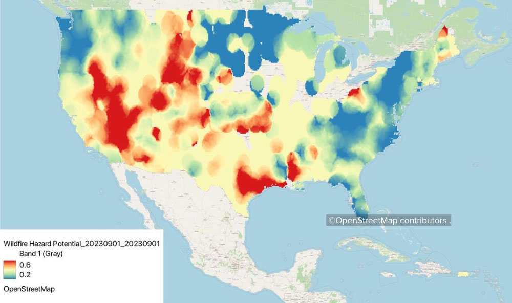
IBM is focusing on technical builders, developers, and data scientists, acknowledging that climate-related data is not just for climate scientists and meteorologists. Instead, businesses in various sectors are increasingly looking for ways to integrate environmental data into their operations. Research shows that climate-related disasters, such as floods and wildfires, are causing significant financial losses, prompting organizations to seek tools to build resilience and better manage risks.
Key Datasets in Environmental Intelligence:
- Satellite Imagery: The EI platform offers access to open-source, high-resolution satellite imagery captured by European satellites every five days. This imagery supports a wide range of applications, including environmental monitoring and regulatory compliance. By using IBM’s platform, users can avoid the challenges of pre-processing the raw imagery, such as cloud removal, which can be a difficult and time-consuming task when working with the data independently.
- Meteorological Data: The platform provides access to historical records, real-time weather updates, and short-term forecasts. This data can be used to inform climate planning and resilience strategies, including long-term climate projections.
Practical Applications for Businesses
Organizations are encouraged to think about specific business challenges related to climate risks, such as:
- Building resilience against natural hazards like floods and wildfires.
- Managing disaster risk planning and conducting risk assessments.
- Calculating and reducing carbon emissions to meet sustainability goals.
IBM’s Environmental Intelligence platform is tailored to help businesses address these issues by providing data and tools to make proactive, informed decisions.

David Blanch highlighted that companies are increasingly operationalizing sustainability by linking industrial assets to carbon equivalents, such as tracking methane emissions within current workflows. These workflows often involve traditional operational roles rather than sustainability-focused teams. For instance, work orders are generated for maintenance tasks by employees who may not be directly involved in sustainability initiatives.
Expanding Sustainability Solutions Across Industries
Blanch noted that IBM aims to go beyond traditional applications and expand its Environmental Intelligence (EI) platform to benefit various industries. For example, IBM’s EI technology is already being used successfully in agriculture, with use cases like crop monitoring, yield prediction, and precision farming. This demonstrates the broad applicability of environmental data across different sectors.
Sustainability Regulations and Compliance:
A significant benefit of easier access to satellite data is enabling organizations to comply with evolving environmental regulations. One such example is the European Union’s deforestation regulation, which mandates companies to assess and verify that their supply chains are not tied to suppliers engaged in illegal land-use changes. IBM’s EI platform helps businesses meet such regulatory requirements by providing the necessary data to review and verify their supply chains.
Animal Growth and Environmental Conditions:
IBM’s EI technology is also being used in agriculture to influence animal growth and optimize nutrition based on environmental conditions. For instance, some organizations have developed predictive models using weather data from the platform to assess mycotoxin levels in crops, allowing them to make better operational decisions.
The Potential of Remote Imaging and Easy Access to Data
Blanch emphasized the power of third-party remote imaging and how it allows businesses to access pre-processed, curated datasets without requiring them to be climate experts or meteorologists. IBM’s goal with the EI software is to provide accessible tools, complete with tutorials, samples, and guides, so users can easily integrate environmental data into their applications, models, or workflows. This democratizes access to valuable environmental insights, empowering businesses to apply them effectively in their operations.


